Brick Bay - Landezine International Landscape Awards
We are proud to share that our Brick Bay project was shortlisted for the Landezine International Landscape Award 2026 in the Revisited Landscapes category.
Selected alongside two outstanding international projects—Conversion Airfield Bonames (Germany) and Rhône River Banks (France)—the shortlist recognised projects that demonstrate the long-term value of landscape architecture through thoughtful adaptation and enduring design outcomes.
While Brick Bay was not the overall winner, being shortlisted among such an exceptional field of projects from around the world is an achievement we are incredibly proud of. The recognition reflects the strength of the project, our collaboration with the client and wider project team, and the quality of landscape architecture being delivered from Aotearoa New Zealand.
The landscape is not preserved — it is inhabited, productive, and still growing.
Context & Site
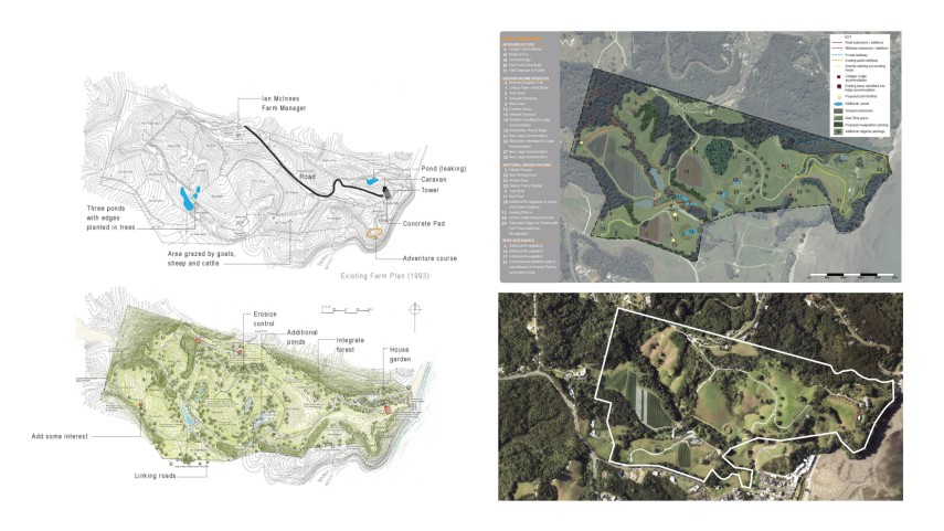
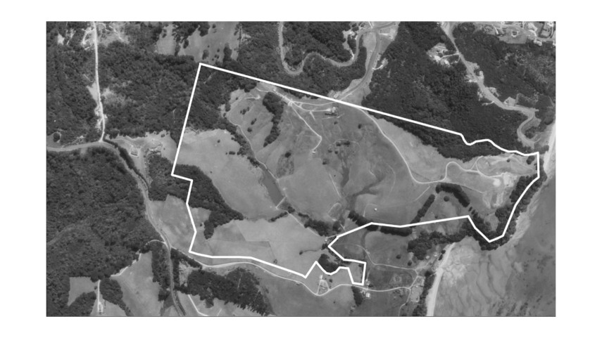
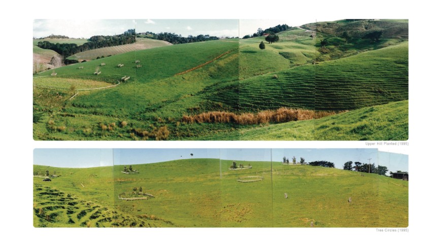
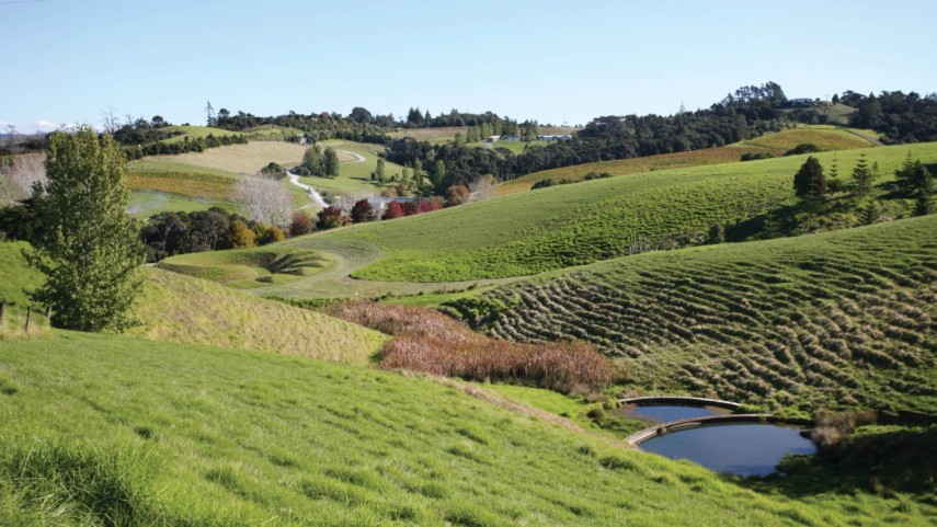
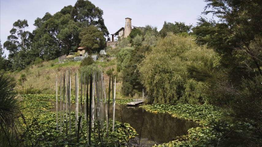
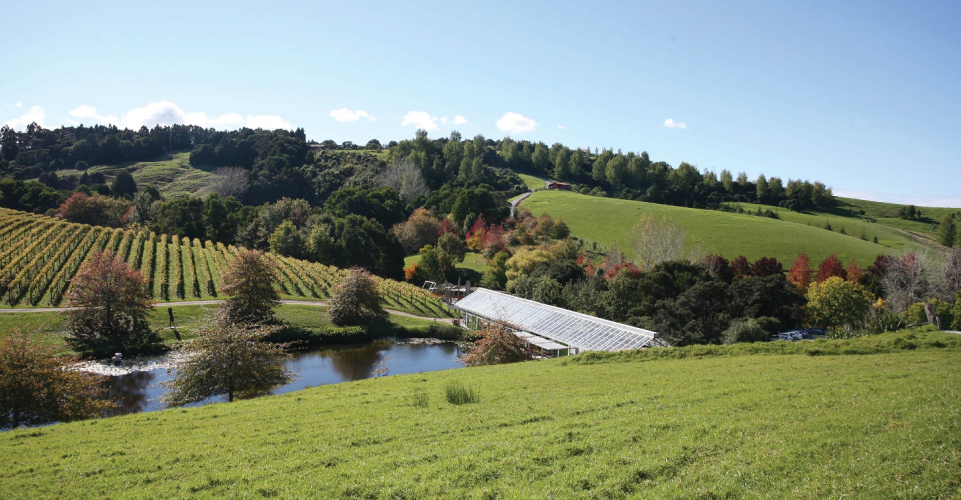
What was once a run-down coastal runoff block, eroded, leaking, and marginal, is now one of New Zealand's most distinctive public landscapes. Brick Bay Farm Park occupies 150 hectares of coastal headland on the Hauraki Gulf, one hour north of Auckland: drowned river valleys, steep ridgelines, and boggy valley floors carrying deep historical layering: a Māori pā commanding the bay's fishing grounds, early European brick-making from beach clay, and a mid-nineteenth century connection to Governor Grey's Kawau Island estate. The property they purchased in 1986 had been stripped of its kauri and left in eroded kikuyu pasture; the valley ponds were leaking, the steepest slopes were losing ground, and there was no masterplan, only ambition, an incomplete homestead, and a 90-hectare problem.
A Landscape Ahead of Its Time
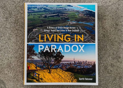
In 1994, landscape architect Garth Falconer of Reset was commissioned to develop a framework for the property. What followed was not a masterplan executed toward a fixed vision, but fifteen years of deliberate, iterative design, ecological restoration, productive land use, spatial narrative, and public art developed simultaneously on a working farm. This integration was genuinely unusual in New Zealand in the 1990s, anticipating by more than a decade the wider discourse around productive landscapes and the civic role of privately-owned open space. The project drew explicitly on the tradition of the ferme ornée, not as nostalgia, but as a working model: a landscape that could be ecologically functional, economically productive, culturally meaningful, and publicly accessible, all at once.
Design Through Time
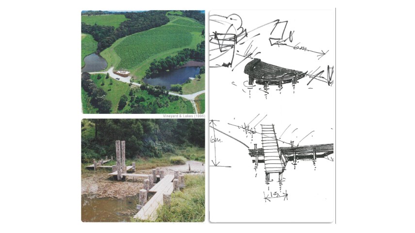
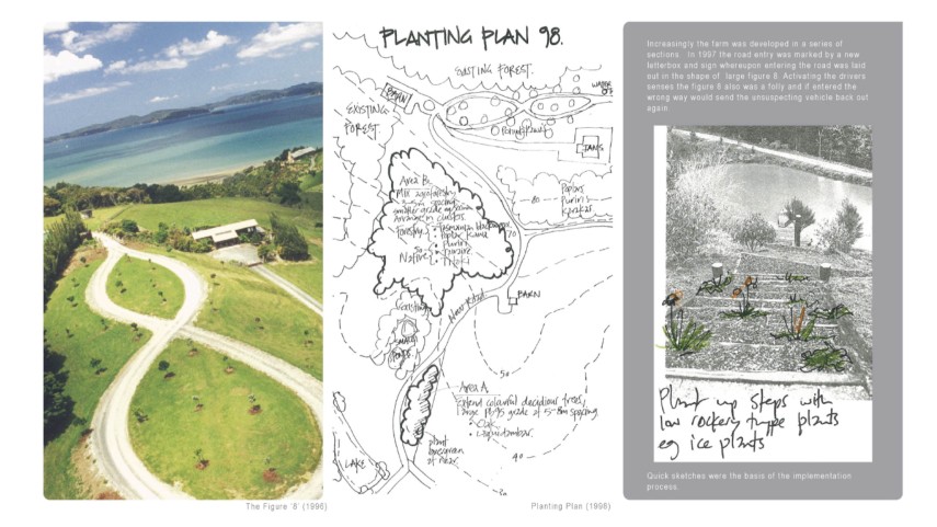
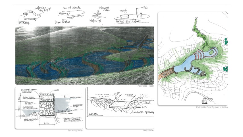
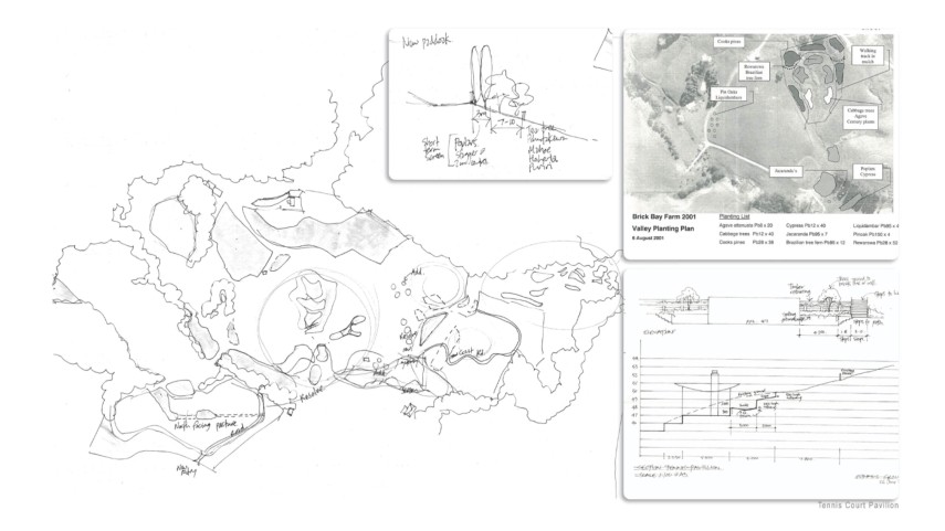
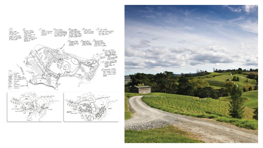
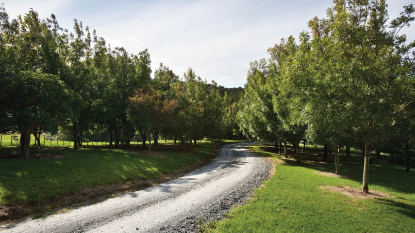
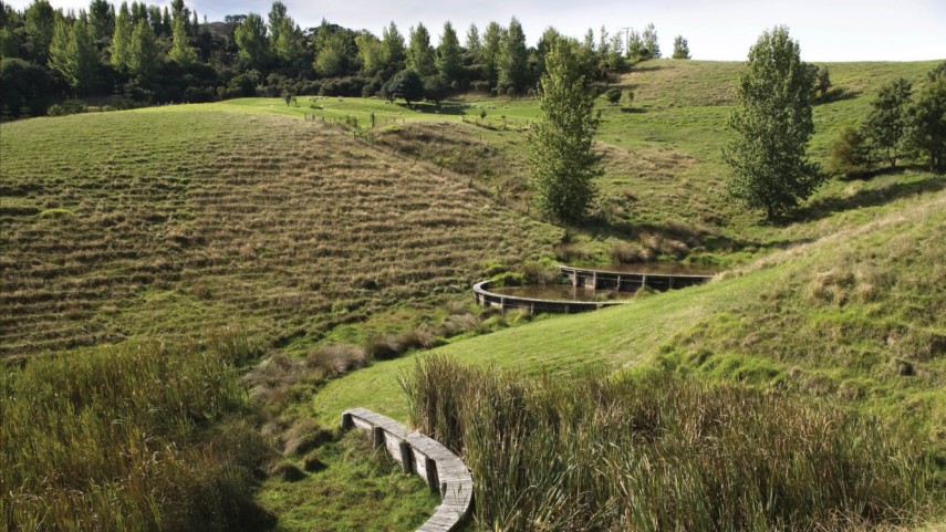
The first season established the logic that would govern the project for the next fifteen years: address the steepest, most vulnerable ground first. Large sections of south-facing slopes were fenced off and planted in mānuka, pūriri, tairare, karo, and flax, with poplar poles introduced for immediate scale and wind protection. The leaking valley ponds were remade. The existing gravel road, which took the shortest route directly to the headland, was entirely rerouted. Rather than efficiency, Falconer designed for revelation: the road now weaves deep into the centre of the farm, heading west before turning back east beneath the ridge, drawing visitors into the landscape before the coast appears. At the entry, a figure-of-eight loop completed the choreography, a spatial move rooted in the English serpentine tradition, and one that had an immediate practical effect: a driver entering the wrong way was automatically returned to the road.
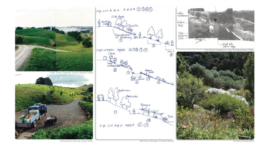
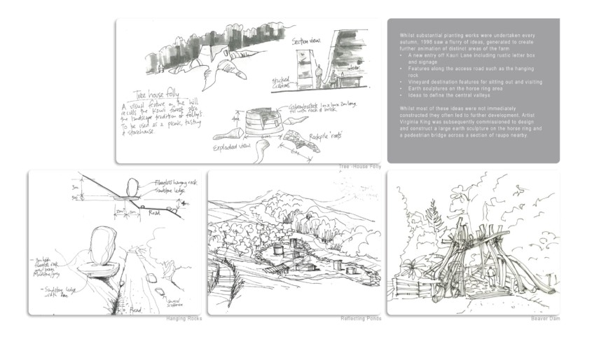
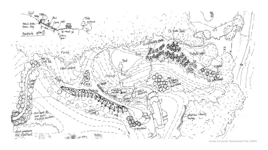
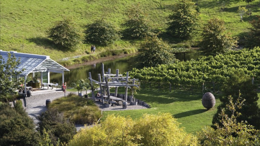
Each January, designer and client met to set the year's strategy. Sketches developed in three dimensions; planting lists were implemented each autumn. As the planting established, ambitions grew. A boutique vineyard was introduced on the western section, relatively new to the area, and experimenting with Pinot Gris. Around the house, an orchard of olive trees, citrus, bananas, passionfruit, and avocados took shape, a direct invocation of the ferme ornée, productive and beautiful in the same gesture.
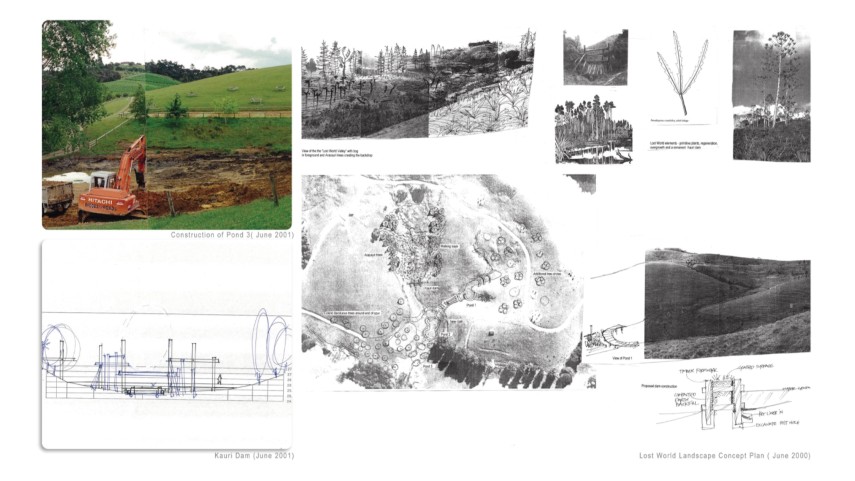
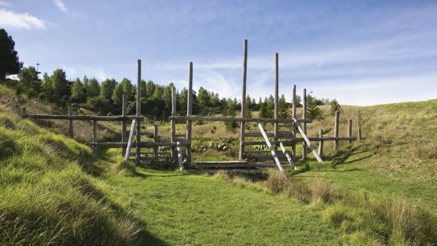
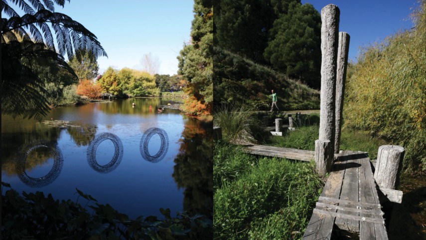
The valley systems, wet, steep, and resistant, became the most ambitious spaces. The broader valley became the 'Lost World': planted in araucarias and prehistoric-foliaged species evoking the site's kauri past, a landscape that reads as primordial rather than planted. At its base, an abstract Kauri dam was constructed with craftsman Sam Simonsen, a structure that, by the time it was complete, stood twice as large as anyone had anticipated.
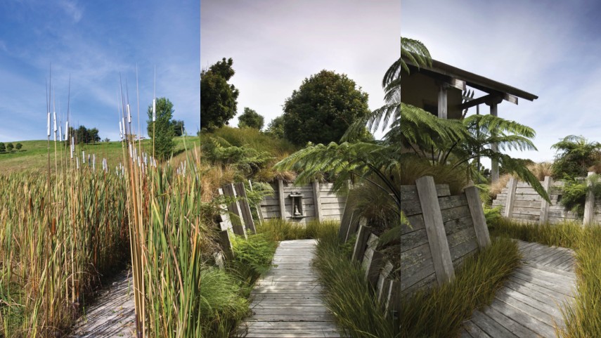
The spiralling earthwork hill that anchors the central valley has a more complicated authorship. Falconer proposed the earthwork form in 2000, on the site of the Didsbury daughter's cherished pony ring. The clients took the idea to artist Virginia King, whose initial drawings Falconer found underdeveloped; he directed her toward more spatially layered forms, which she developed into the finished work. The credit has been King's, and Falconer has been candid about the dynamic, his consolation was the Kauri dam, built to his own specification and at a scale that exceeded everyone's expectations. King also conceived independently a raupo bridge strung with fishing-rod canes and bells that ring as the boards see-saw underfoot, a quietly affecting piece that has weathered into the landscape without losing its intent.
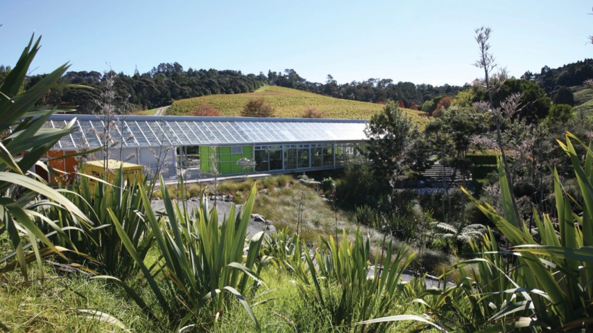
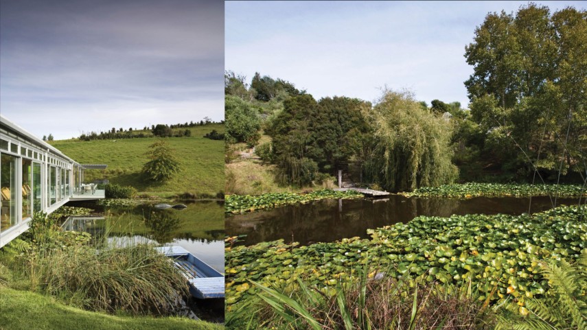
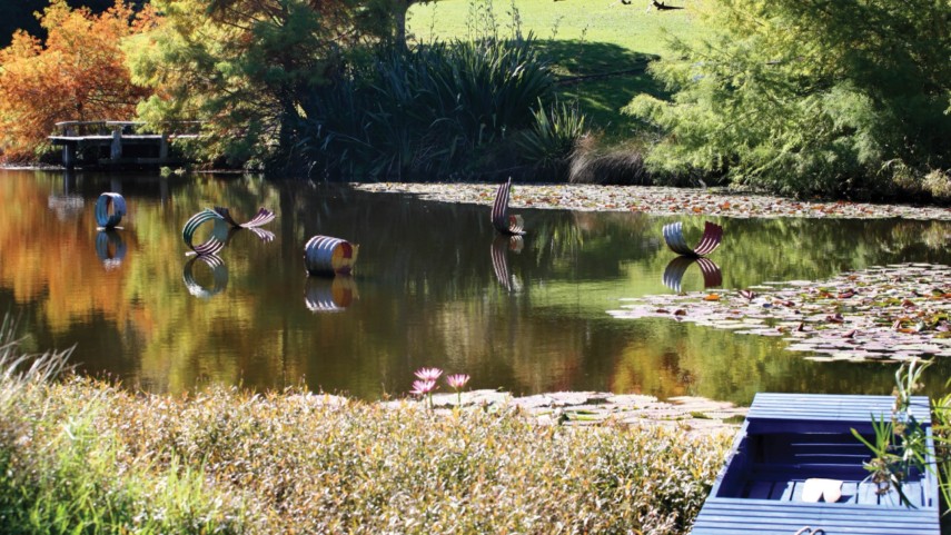
In 2002 a further 60 acres were added. A public sculpture walk opened in 2004; the Noel Lane-designed Glasshouse, cantilevered over a waterlily-fringed lake and a national architecture award winner, anchored it in 2007. The farm had become a public place without ceasing to be a farm. A 2009 development plan was not a completion document but a forward projection, showing the opportunity of future extended trails, new water bodies, retrofitted barns, vineyard extensions, a deliberate act of incompleteness.
A Landscape That Keeps Generating
Three decades on, the maturity of that original framework is measurable. Tens of thousands of native trees and plants have been established across the property reforesting gullies, regenerating wetlands, and reclaiming slopes that were losing ground when the Didsburys arrived. The kauri forest now closes over the trail. Kerērū, tūī, kākā, and pīwakawaka have returned to what was eroded pasture. A visiting landscape architect observed that with age, 'the property, and the skill of the landscape architect, are becoming more evident.' The 2km sculpture trail features 60+ rotating works curated by the Brick Bay Sculpture Trust, which provides interest-free loans to artists creating new pieces. Since 2016, the annual Brick Bay Folly, a blind-judged design-build competition for emerging architects, has placed experimental structures in the landscape; the 2025 edition engaged directly with the tradition of Māori hākari stages, continuing the project's long conversation with the cultural history embedded in the site. Qualmark Gold certification confirms the farm remains a working, publicly accessible landscape daily.
What the original design made possible was not a finished place but a framework capable of receiving use, growth, and meaning over time, and that capacity has not diminished.
The landscape is not preserved — it is inhabited, productive, and still growing.
Context & Site
Brick Bay Farm Park occupies 150 hectares of coastal headland on the Hauraki Gulf, one hour north of Auckland: drowned river valleys, steep ridgelines, and boggy valley floors carrying deep historical layering: a Māori pā commanding the bay's fishing grounds, early European brick-making from beach clay, and a mid-nineteenth century connection to Governor Grey's Kawau Island estate. When Richard and Christine Didsbury purchased the property in 1986, it had been stripped of its kauri and left in eroded kikuyu pasture; the valley ponds were leaking, the steepest slopes were losing ground, and there was no masterplan, only ambition and a 90-hectare problem.
A Landscape Ahead of Its Time
In 1994, landscape architect Garth Falconer of Reset was commissioned to develop a framework for the property. What followed was not a masterplan executed toward a fixed vision, but fifteen years of deliberate, iterative design, ecological restoration, productive land use, and public art developed simultaneously on a working farm. This integration was genuinely unusual in New Zealand in the 1990s, anticipating by more than a decade the wider discourse around productive landscapes. The project drew explicitly on the tradition of the ferme ornée: a landscape that could be ecologically functional, economically productive, culturally meaningful, and publicly accessible, all at once.
Design Through Time
The first season established the governing logic: address the steepest, most vulnerable ground first. South-facing slopes were fenced and planted in mānuka, pūriri, karo, and flax. The leaking valley ponds were remade. The existing gravel road was entirely rerouted: rather than efficiency, Falconer designed for revelation, weaving the route deep into the farm before the coast appears. A boutique vineyard and an orchard of olives, citrus, and avocados took shape around the house, a direct invocation of the ferme ornée, productive and beautiful in the same gesture.
The valley systems became the most ambitious spaces. The broader valley became the 'Lost World': planted in araucarias and prehistoric-foliaged species evoking the site's kauri past, primordial rather than planted. At its base, an abstract Kauri dam was constructed with craftsman Sam Simonsen at a scale that exceeded everyone's expectations. A spiralling earthwork hill anchors the central valley, its authorship shared between Falconer and artist Virginia King. King also conceived a raupo bridge strung with fishing-rod canes and bells, a quietly affecting piece that has weathered into the landscape without losing its intent.
A public sculpture walk opened in 2004; the Noel Lane-designed Glasshouse, cantilevered over a waterlily-fringed lake, anchored it in 2007. The farm had become a public place without ceasing to be a farm.
A Landscape That Keeps Generating
Three decades on, tens of thousands of native trees have been established across the property, reforesting gullies, regenerating wetlands, and reclaiming eroded slopes. Kerērū, tūī, kākā, and pīwakawaka have returned. The 2km sculpture trail features 60+ rotating works curated by the Brick Bay Sculpture Trust. Since 2016, the annual Brick Bay Folly, a blind-judged design-build competition for emerging architects, has placed experimental structures in the landscape; the 2025 edition engaged directly with the tradition of Māori hākari stages, continuing the project's long conversation with the cultural history embedded in the site.
What the original design made possible was not a finished place but a framework capable of receiving use, growth, and meaning over time, and that capacity has not diminished.
Credits - Client: Richard and Christine Didsbury/ Architecture: Noel Lane Architects (Glasshouse)/ Sculpture Walk: Anna Didsbury, Brick Bay Sculpture Trust/ Artists: Virginia King, Chris Booth, Phil Dadson
Original Journal by Landezine Awards: landezine-award.com/brick-bay-farm-park